There's only one problem! It's a eight hundred page document, mostly maps, and all of those maps are at incredibly low resolution. Most of the maps, despite being saved in a file format perfectly able to handle high-density vector data, are vector files saved as low resolution images and pasted in.
Exhibit A: the Open Space and Parks Map
Looks OK, right? Here's what happens when you zoom into the PDF:
It's a pixel disaster the likes of which I haven't seen since the PDFs the Port Authority puts out. True, slightly higher resolution maps exist for each specific neighborhood, but you don't hurt anybody's pixels by making the city-wide map, you know, readable too.
Here's the deal, City, in case you never got the memo:
It's OK to produce detailed, data-rich documents. This is the Internet Age, we can handle it. And for god's sake, don't put text in images without extracting it into something searchable. I wouldn't have found this whole page of blight maps via search, even thought that's text right there:
And I guess this would actually be pretty interesting data, if I could zoom in on the maps at all without getting a good idea of the number of Vacant Parcels in Pixelville:
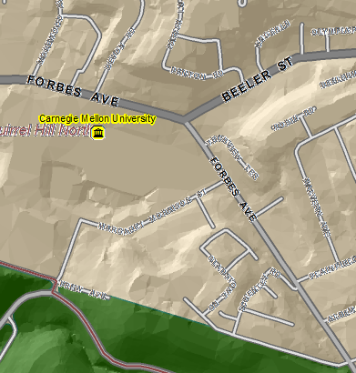
And as for PGHSNAP's sister Project, PGHGIS, I'll like you better when you don't have such intersting rendering-issues, and are a little more navigable:

This isn't transparency in government quite yet- its more of a hazy translucence, like windows that have newspaper taped over them.
I'd love to find some real life examples of such windows, but the blight maps are too pixilated for me to see.
Oh. SNAP.


LOOKS LIKE MAPS PAINTED BY MATISSE!
ReplyDelete